
The corridor query tab retrieves collision data within a user specified corridor and allows defining the inclusion of start, end or intermediate intersection related collisions. Excluding the intermediate collisions means the focus will be on only midblock collisions.
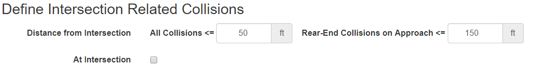
The corridor query works in conjunction with the Define Intersection Related Collision section.
The intersection collision definition applies to how collisions on the corridor are interpreted. In the example below, the corridor is Hollywood Blvd and the start and end intersections are Argyle Ave and Cherokee Ave.
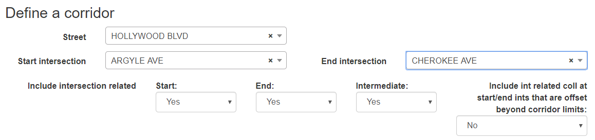
An additional option is provided to include or exclude intersection related collisions for the start/end intersections that are outside the corridor bounds. This refers to collisions that are within the defined distance for an intersection collision of the start/end intersections but are offset directionally outside the corridor bounds.
As with the other query options, the query respects the timeframe and other filters that were selected. Refer to building a query help file for additional information.
If within the Define Corridor section there is a map outlining the corridor an additional option is provided. In a small number of cases after selecting a corridor, the route will divert onto other streets. A new option is now available to add calibration points to a chosen corridor to ensure all of the corridor is properly selected. For example, in Los Angeles if you select Sunset Blvd from Pacific Coast Highway to Ladera Dr, the corridor gets diverted along Wilshire Blvd:

To correct the corridor path you need to add calibration points near the intersection of Sunset Blvd with Pacific Coast Hwy. You can do this simply by clicking on the map at points along Sunset Blvd. It will add the black cross mark each time you click a point. In this case, the route simply needed an additional calibration point between Marquez Ave and Livorno Dr close to the starting intersection at Pacific Coast Hwy:

It may take multiple attempts to add calibration points, but portions of roadway with extensive curvatures or near trails or parallel side streets are likely candidates for extra calibration points. After you have added the calibration points, click the Recalculate Route button below the map. The new route for the corridor will be shown with the additional calibration points:

The corridor now properly follows Sunset Blvd and will ensure all the collisions on the corridor are queried. If the results are not as expected, you can click on the map again to add new calibration points.